Planning a Gwanaksan hike from Seoul National University? You’re in for one of Seoul’s most rewarding mountain experiences — a 632.2 m peak with rocky ridges, a hermitage at the summit, and sweeping city views, all reachable by subway in under an hour from central Seoul.
Contents
- Getting There by Subway
- Trail Guide: SNU Entrance to the Summit
- Practical Tips for Foreign Hikers
- Final Thoughts
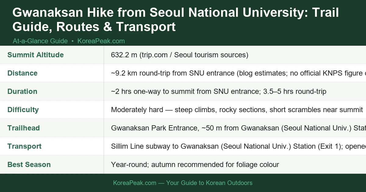
how to hike gwanaksan from seoul national university — key facts at a glance.
Getting There by Subway
The easiest way to reach the trailhead is via the Sillim Line, which opened on 28 May 2022. Ride to Gwanaksan (Seoul National Univ.) Station and come out of Exit 1 — the Gwanaksan Park Entrance is literally about 50 metres from where you surface. It doesn’t get more convenient than that for a Seoul mountain hike.
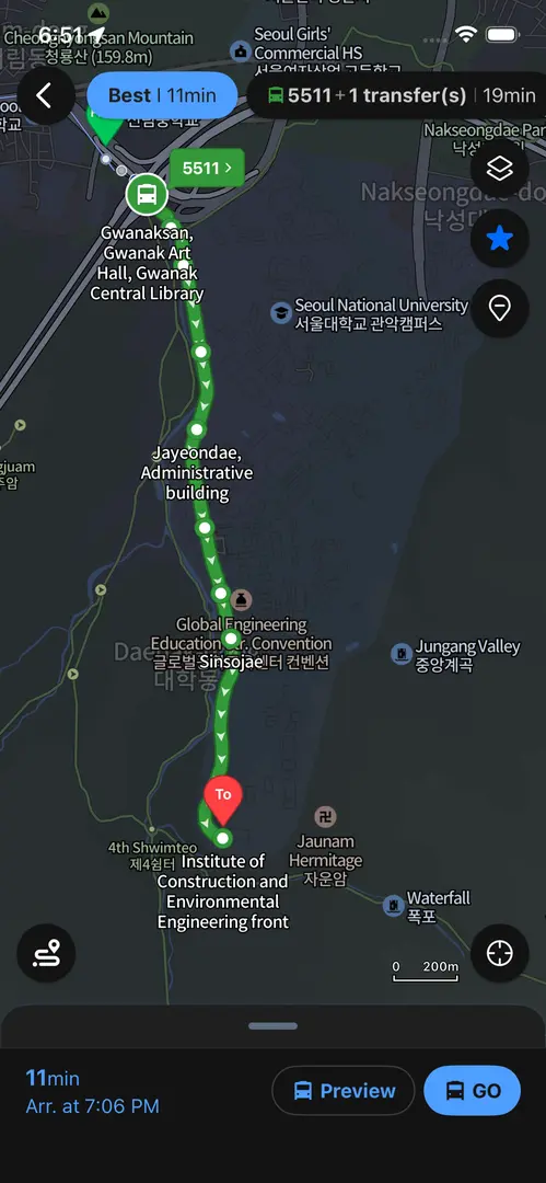
Navigate from Gwanaksan Station to the trailhead with this detailed map showing the 11-minute Bus (5511) route to Seoul National University’s hiking entrance.
One heads-up for international visitors: Google Maps is unreliable for navigation in South Korea. Instead, use Naver Map or KakaoMap — both have English-language interfaces and accurate transit data. To search for the trailhead, copy and paste this into either app: 관악산공원 입구 (Gwanaksan Park Entrance). That’ll get you exactly where you need to be.
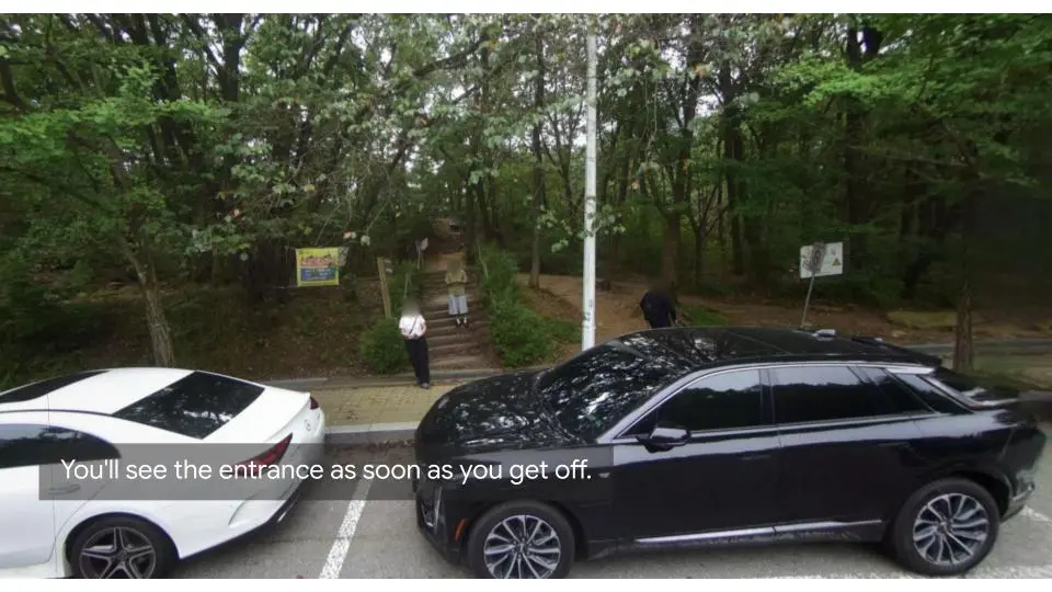
The trailhead entrance comes into view immediately after exiting the bus at Seoul National University’s Gwanaksan hiking access point.
Trail Guide: SNU Entrance to the Summit
The First 20 Minutes: Into the Forest
From the park entrance, follow the well-marked signs pointing toward Yeonjudae — that’s the hermitage perched just below the summit and your ultimate destination. The first stretch winds through pleasant forest, and after roughly 20 minutes the trail merges near the Construction Environment Research Institute. From there, the path becomes more defined and the real climbing begins.
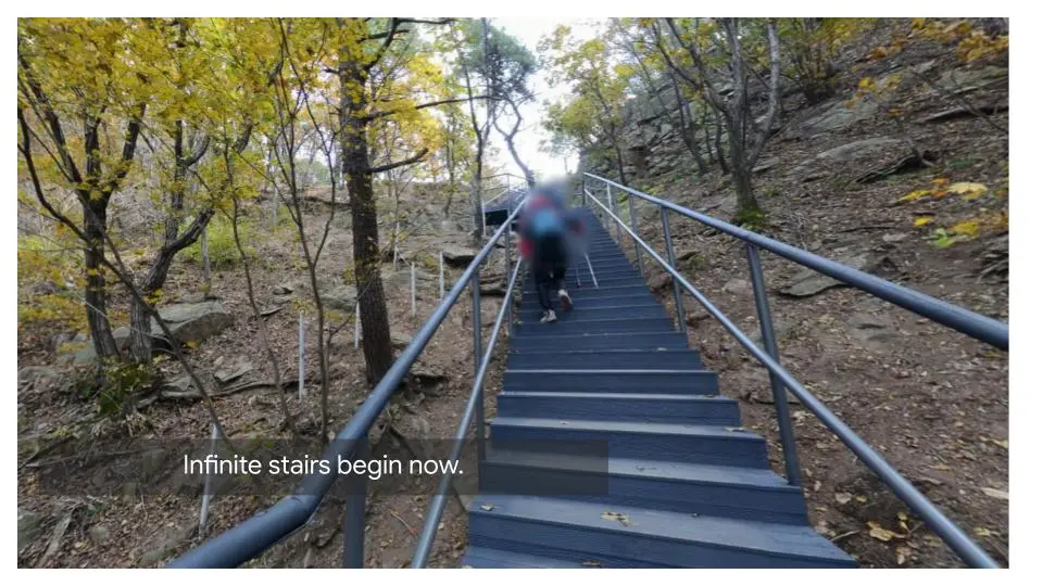
The infamous infinite staircase section tests hikers’ endurance as the trail climbs steeply through the forested slopes of Gwanaksan.
The Middle Section: Ridges and Rocky Steps
This is where Gwanaksan earns its reputation as a moderately hard mountain. Expect steep staircases cut into the hillside, exposed rocky ridges, and a few short scrambles as you approach the upper reaches. Trail shoes with solid grip are important here — smooth-soled sneakers are a bad idea on the wet rock sections. Budget around 2 hours one-way at a comfortable hiking pace.
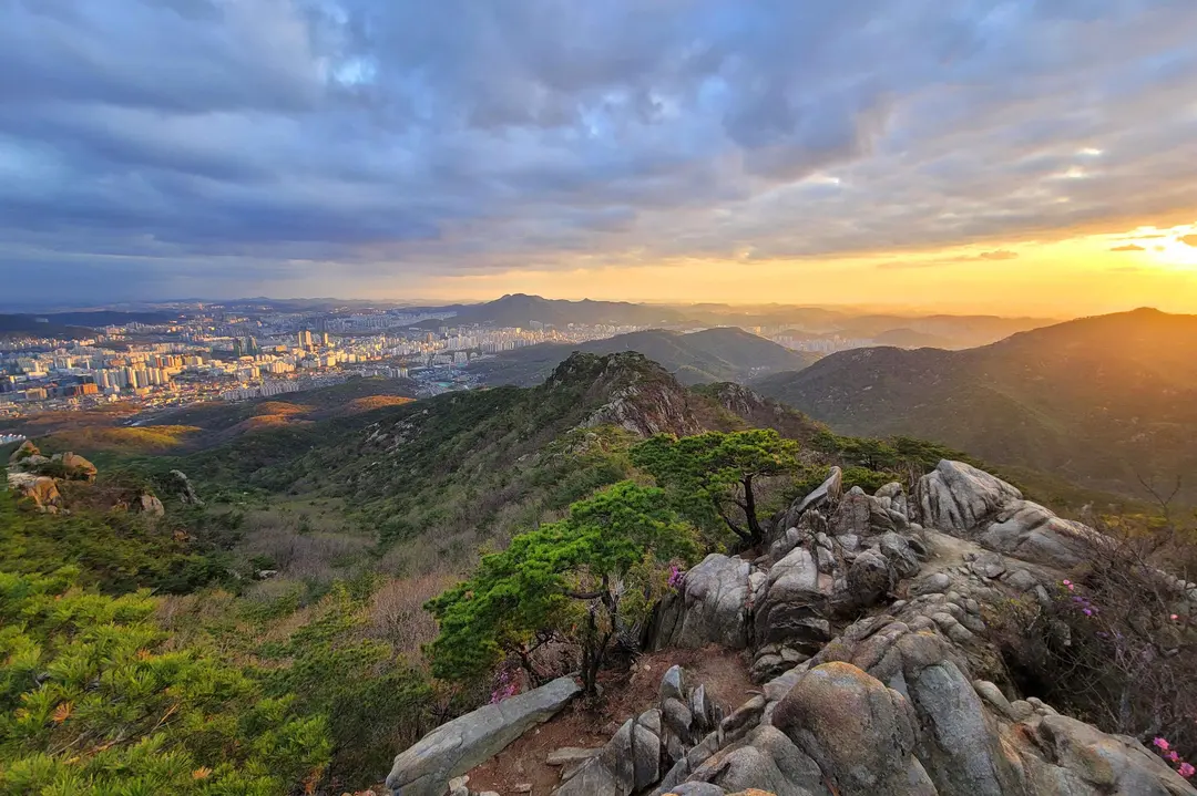
From Gwanaksan’s rocky peak, Seoul sprawls beneath a golden sky—the perfect reward for hiking from SNU. Source: ⓒ한국관광공사 포토코리아-박정아
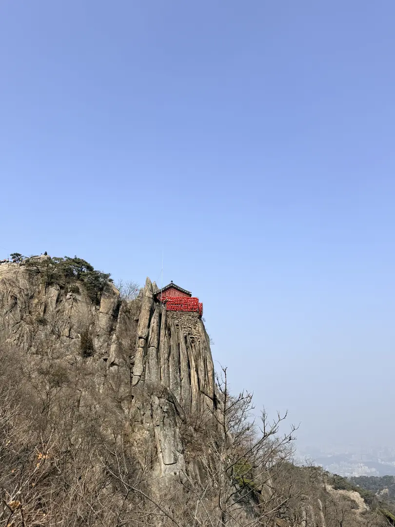
The Summit: Yeonjudae Hermitage
The reward at the top is Yeonjudae, a hermitage perched dramatically just below the 632.2 m summit. It’s one of the most photographed spots in Seoul’s mountains — and for good reason. On a clear day the panorama over the city is spectacular. Take your time up here before heading back down.
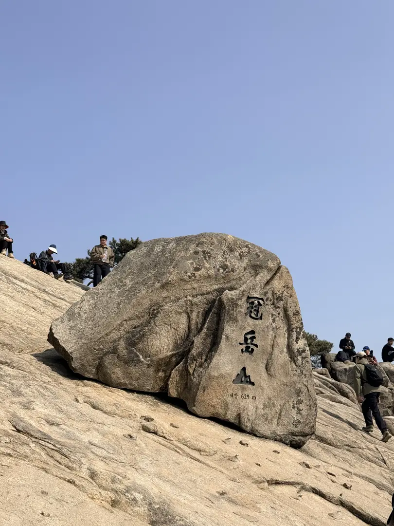
Hikers gather at Gwanaksan’s iconic summit stone marker, the rewarding endpoint of the Seoul National University trail.
Descent Options
You can return the same way you came up, or consider the Gwacheon valley descent on the opposite side of the mountain, it’s generally considered less steep and less punishing on the knees than the SNU ascent route. If you’re feeling adventurous, Gwanaksan also connects via Palbong Ridge to Samseongsan Mountain, opening up longer routes for experienced hikers who want a bigger day out. For a standard round-trip via the same route, allow 3.5–5 hours depending on your pace and how long you linger at the top.
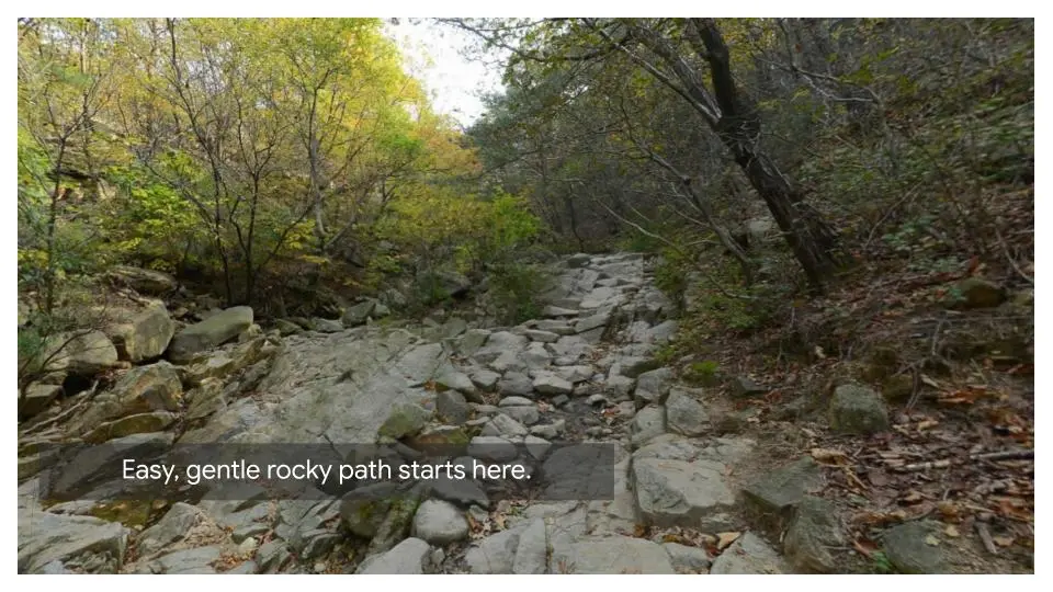
The gentle rocky path unfolds at the trailhead, inviting hikers to begin their Gwanaksan adventure from Seoul National University.
Practical Tips for Foreign Hikers
What to pack before the trailhead
This is non-negotiable: Korean mountain trails have no trash cans and no shops or vending machines on the trail. Before you enter the park, stop at a convenience store, there are CU and GS25 branches near the station, and buy all the water and snacks you’ll need for the entire hike. I’d suggest at least 1.5 litres of water per person; there are no reliable refill points along the route. And whatever you bring up, take all your trash back down with you. That’s just how Korean mountain culture works, and it’s why these trails stay so clean.
What to Wear and Carry
- Trail shoes or hiking boots with good grip, essential for rocky and wet sections
- Enough water for the full round-trip (no on-trail refills available)
- Snacks purchased before entering the park
- A light rain layer. Seoul weather can change quickly
- Trekking poles if you’ve bad knees (gear rental available at the Seoul Hiking Tourism Center)
Seoul Hiking Tourism Center
There’s a Seoul Hiking Tourism Center at Gwanaksan that’s particularly useful for first-timers. They provide trail maps, route information, and promotional materials, and they offer gear rental including backpacks, hiking shoes, clothing, and trekking poles. If you want a guided tour, you can book in advance at seoulhiking.or.kr. It’s a fantastic resource that not enough visitors know about.
Seasonal Advice and Fire Closures
Gwanaksan is a year-round destination, with autumn strongly recommended for the foliage colour along the trail. Spring is also beautiful, but be aware that Korean national and city parks enforce fire prevention trail closures in spring and autumn, typically during dry, windy periods. Sections of the trail can be temporarily closed without much advance notice online. I’d suggest checking trail status on Naver Map or KakaoMap the morning of your hike, or calling ahead if you’re visiting during late March–May or October–November.
Navigation on the Mountain
Gwanaksan is well-signed in Korean, with distance markers and directional posts at most junctions. The key word to follow is 연주대 (Yeonjudae), that points you toward the summit. Download an offline map before you head up, since mobile signal can be patchy on the upper ridges.
Final Thoughts
The Gwanaksan hike from Seoul National University is one of those experiences that surprises people — it’s hard to believe a mountain this dramatic is accessible by a single subway ride from the city centre.